In 1976, a bulldozer operator leveling ground in El Salvador’s Zapotitán Valley for a grain-storage project struck something that wasn’t rock — shaped walls, ceramic vessels, and the unmistakable geometry of human habitation, sitting exactly where someone had left it roughly 1,400 years before. That accidental cut would eventually pull archaeologist Paul Sheets into one of the most remarkable excavations in the Americas, and open a window onto a world the volcanoes had swallowed whole.
The Bulldozer That Cracked Open a Lost World
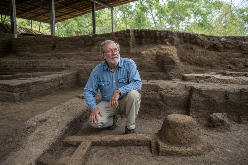
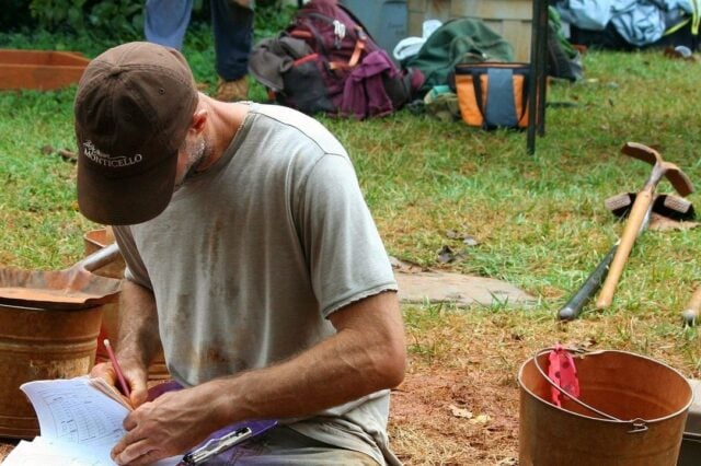
Sheets, a University of Colorado archaeologist, was called in to assess what the construction crew had found. What he recognized — and what subsequent excavation would confirm — was an entire Maya farming village, frozen mid-breath beneath layers of volcanic ash. The site, eventually named Joya de Cerén, would earn UNESCO World Heritage status and the nickname “the Pompeii of the Americas.” But it is only the most famous entry in a roster of at least six major pre-Columbian sites scattered across this small Central American nation.
The cruel irony threading El Salvador’s ancient history is also its saving grace. The same volcanic violence that periodically erased communities sealed them in near-perfect preservation, locking the texture of ordinary life inside geological time capsules that open-air ruins, battered by erosion and centuries of looters, can rarely match. Disaster, it turns out, can be the most conscientious of archivists.
Joya de Cerén: A Village Caught at Dinner
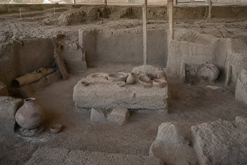
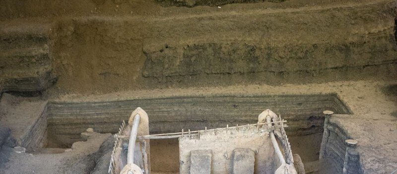
When Sheets and his teams — he began formal excavations in 1978 and returned across subsequent decades — peeled back the layers of ash deposited by the Loma Caldera eruption around AD 630, they found sleeping mats still rolled in corners, food crops still standing in garden furrows, and ceramic pots containing meals that had never been eaten. The village’s inhabitants had apparently fled into the night with enough warning to survive, but not enough time to take their belongings.
The recovered inventory reads like the most unglamorous shopping list imaginable: painted gourds, obsidian blades, stored beans, chili peppers. No throne rooms, no jade burial masks — just the working contents of Maya farming households. That is precisely what makes Joya de Cerén, located about 32 kilometres from modern San Salvador, so valuable to archaeologists. Most Mesoamerican sites capture the powerful. This one captured the ordinary.
The ash layers preserved even the impressions of leaves and thatch, allowing researchers to reconstruct roof angles and garden layouts with unusual precision. The village effectively became a three-dimensional photograph of seventh-century agricultural life — a photograph nobody posed for and nobody intended to take.
And then there is the detail that tends to stop visitors cold: archaeologists uncovered a sweat bath — a pre-Columbian sauna — that had been stocked and apparently readied for use the very evening the eruption came. Someone had planned a perfectly ordinary night that never arrived. That small, specific fact, the prepared sweat bath awaiting a bather who never returned, carries more human weight than almost any monument could.
As UNESCO’s designation notes, the site contains “the remains of a pre-hispanic farming village that was covered by a volcanic eruption in the seventh century AD” — a plain-spoken description that somehow undersells the intimacy of what the ash preserved.
San Andrés: The Regional Capital the Valley Forgot
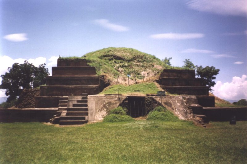
Less than ten kilometres from Joya de Cerén, San Andrés Archaeological Park stands as one of the largest pre-Hispanic centers in El Salvador, a site that served as a regional capital from roughly AD 600 onward. Where Cerén is intimate and horizontal, San Andrés is monumental: stepped pyramid platforms and wide ceremonial plazas speak to a ruling class organizing tribute, ritual, and trade across a substantial territory.
The relationship between the two sites gives archaeologists — and curious visitors — a rare vertical slice through Maya society. San Andrés administered the valley; Cerén’s farmers worked it. Both were affected by the same geological forces, destroyed at overlapping moments in history, and rediscovered within kilometres of each other. Walking San Andrés’s ceremonial plazas today, it is possible to hold both scales of this ancient world in mind simultaneously: the elite decisions made on these platforms and the beans growing in Cerén’s furrows a short walk away, each dependent on the other, each now equally legible to researchers who have spent decades piecing together the valley’s layered past.
Tazumal and Casa Blanca: Pyramids in the Coffee Country
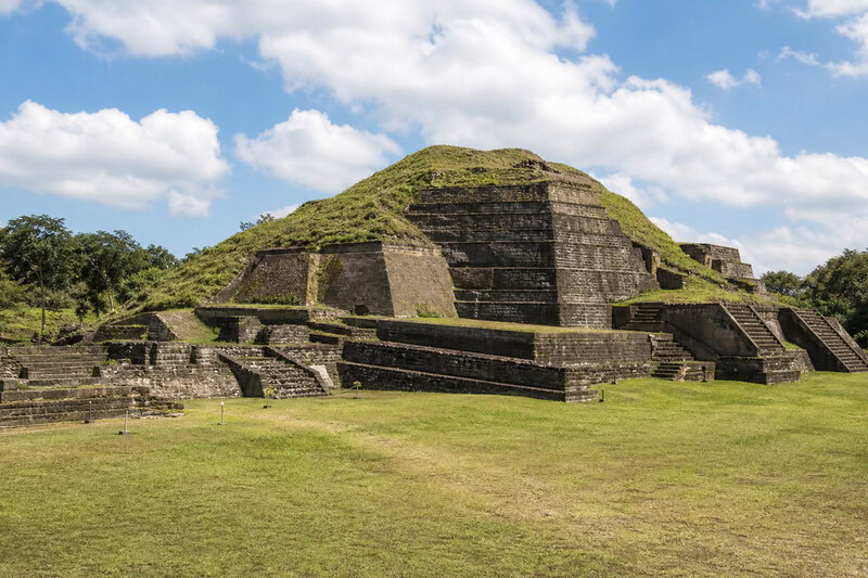
In the western highlands near the town of Chalchuapa, Tazumal rises as the tallest pyramid in El Salvador — a stepped structure reflecting centuries of layered construction, with evidence of occupation stretching back more than 3,000 years and trade connections reaching as far as Teotihuacán in central Mexico. For anyone who reflexively associates Maya ruins only with Guatemala or the Yucatán Peninsula, Tazumal is a quiet correction.
Nearby Casa Blanca, a Maya archaeological site also anchored in the Chalchuapa area, features a collection of painted stelae and an on-site museum where visitors can observe active conservation work, including an excavation tunnel that offers an unmediated view of ruins still gripped by roots and soil — archaeology as it looks before restoration tidies it up. It is one of the more candid presentations of the past available anywhere in Central America.
Together, Tazumal and Casa Blanca confirm that El Salvador’s Maya ruins and archaeological sites were active participants in the same cultural and trade networks that produced Tikal and Copán. The Chalchuapa region’s long occupation record also illustrates a broader pattern in El Salvador’s pre-Columbian story: this is not the history of a single culture, but a layered sequence of peoples — Olmec-influenced, Maya, Pipil — each building over or beside what the last left behind.
Cihuatán: The City That Burned — and Not by a Volcano
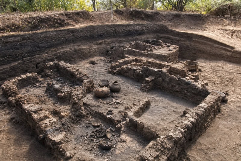
Cihuatán, in central El Salvador and dating to the early Postclassic period (roughly AD 900-1200), breaks the volcanic-preservation pattern with a darker twist. Evidence at the site suggests it was deliberately burned and abandoned — possibly in violent conflict — leaving behind charred structural remains and the outline of what was once one of the largest cities in the region. No ash blanket here; just fire, collapse, and the slower work of jungle reclamation.
The site’s name means “place of the woman” in Nahuatl, a linguistic fossil embedded in the landscape that hints at the transition between Maya and Pipil cultural dominance characterizing El Salvador’s late pre-Columbian centuries. Its ceremonial center includes ball courts, platform mounds, and a defensive perimeter — a community that was both ritually sophisticated and, apparently, militarily anxious. Given the evidence of its ending, that anxiety seems to have been well founded.
Cihuatán represents the puzzle piece that complicates any tidy narrative about El Salvador’s ancient sites: not everything ended from the sky, and not every ruin comes preserved by volcanic ash. The manner of its destruction is itself archaeological evidence, pointing toward the political turbulence that accompanied the broader collapse and reorganization of Mesoamerican societies during the Postclassic transition.
Quelepa: The Eastern Outlier and the Limits of What We Know
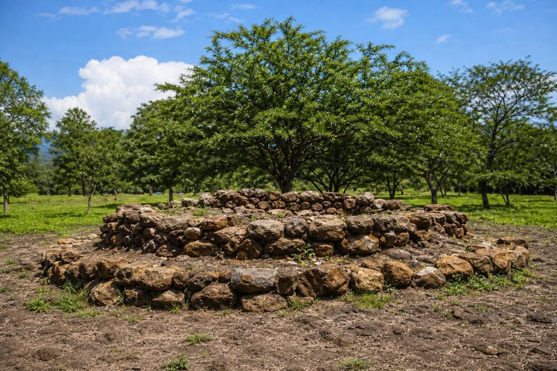
Quelepa, near the Honduran border in eastern El Salvador, sits outside the Maya cultural sphere entirely. Its artifacts and architectural style link it more closely to cultures of Honduras and lower Central America, a reminder that pre-Columbian El Salvador was a crossroads, not a cultural monolith. Occupied from roughly 500 BC to AD 1000, Quelepa features elaborate burial offerings and distinctive ceramic traditions that archaeologists have used to trace migration and trade routes running north-south through the isthmus — threads of connection that colonial-era borders later severed conceptually, even as the archaeology kept proving them real.
The site remains less excavated and less visited than Joya de Cerén or Tazumal, which is itself a kind of data point. El Salvador’s pre-Columbian past is still substantially unwritten, with much of the country’s surface only partially surveyed and many sites likely still waiting beneath coffee plantations and suburban sprawl. The bulldozer that found Cerén by accident was not, in retrospect, an isolated incident so much as a preview of what systematic survey might eventually reveal.
Visiting El Salvador’s Pre-Columbian Sites: Practical Orientation
For travelers considering these sites, a few practical realities are worth stating plainly. Joya de Cerén and San Andrés sit within the same valley and can be combined in a single day trip from San Salvador, with both accessible by public transport or private vehicle along the CA-1 highway. Tazumal and Casa Blanca in Chalchuapa are roughly 75 kilometres west of the capital, easily paired on a western highlands itinerary that might also include the town of Santa Ana. Cihuatán lies north of San Salvador near the town of Aguilares and receives fewer visitors than the western sites, which means less infrastructure but also less crowding. Quelepa, in the far east near San Miguel, requires the most logistical planning and rewards travelers with a genuinely off-circuit experience.
All six sites charge modest entry fees, and several maintain on-site museums with bilingual signage. Early morning visits are advisable year-round; El Salvador’s midday heat is formidable, and the low-angle morning light clarifies the topography of pyramid platforms and plaza alignments in ways that the flat noon sun obscures. At Joya de Cerén in particular, the excavation structures are covered by protective roofing — which makes the site more comfortable to visit but also means overcast days present no real disadvantage.
Guided tours are available at most sites and are worth the additional cost, particularly at Cerén and San Andrés, where the spatial relationship between the two sites gains considerably from explanation. Archaeological sites across El Salvador have improved their visitor infrastructure significantly in recent decades, though English-language resources remain thinner than at comparable sites in Guatemala or Mexico.
What the Ash Gave Back
The deepest argument running through all six sites — Joya de Cerén, San Andrés, Tazumal, Casa Blanca, Cihuatán, Quelepa — is that El Salvador’s turbulent geology, so often narrated as pure catastrophe, also functions as a kind of archive. It preserved details of pre-Columbian life in Central America that erosion, looting, and time have stripped from less violently covered sites elsewhere. The violence of the earth, in this case, did the work that institutions and careful stewardship rarely manage across fourteen centuries.
Sheets, who spent decades returning to the Zapotitán Valley, framed the excavation of Joya de Cerén not as uncovering ruins but as meeting people: the family who left their dinner, the person who stocked the sweat bath, the farmer who planted the last row of maguey — human beings whose names the ash did not save but whose daily routines it did, with a fidelity that no written record from this era could have matched.
For the curious general reader arriving at any of these sites today — walking Tazumal’s pyramid, ducking into Casa Blanca’s excavation tunnel, standing in the eerily domestic rooms of Cerén — the experience available in El Salvador is rarer than the country’s modest profile in international travel culture might suggest. This is not the monumental abstraction of power. It is the texture of actual lives, pressed into ash, waiting with unusual patience for someone to notice.
The bulldozer of 1976 was an accident. Everything Paul Sheets did afterward was not. And the story of El Salvador’s ancient ruins is ultimately the story of what happens when human curiosity meets geological time — and decides, with considerable stubbornness, to keep digging.