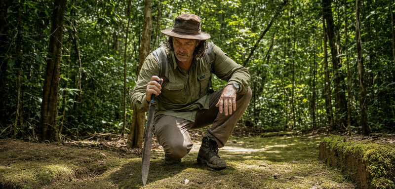
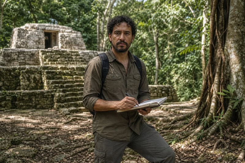
The machete stops. Underfoot, the ground does something the jungle floor is not supposed to do — it rises, levels, angles away with a geometry that water and root alone cannot explain. Renzo Duin has spent more than two decades learning to read Suriname’s interior rainforest like a slow, green manuscript, and he knows, standing here, that someone else wrote this landscape first.
A Continent Reconsidered: The Amazon Was Never Empty
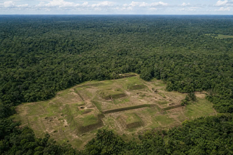
For most of the twentieth century, the Amazon was understood by Western science as a kind of magnificent void — vast, biodiverse, and essentially untouched by complex human society. The influential “counterfeit paradise” thesis held that Amazonian soils were too poor, too leached by rainfall, to support the dense agricultural populations that built cities elsewhere. Small, mobile bands, the thinking went, were all the forest could sustain. It was a tidy theory. It was also wrong.
The instrument that began dismantling it was LiDAR — Light Detection and Ranging — a remote-sensing technology that fires millions of laser pulses from low-flying aircraft, strips away the canopy in the resulting data, and reveals the bare earth beneath in extraordinary detail. When researchers pointed LiDAR at the forests of Brazil and Bolivia, the results were startling: hidden beneath the trees lay dense networks of ancient settlements, ceremonial earthworks, causeways connecting communities across hundreds of kilometres, and the soil signatures of intensive pre-Columbian agriculture. The Amazon, it turned out, had been home to civilizations numbering in the millions. The map of human history had to be redrawn.
Almost everywhere those surveys flew, they rewrote what we thought we knew about pre-Columbian Amazon civilizations and Suriname’s place within that story. There is one significant stretch of the basin, however, where the aircraft have largely not gone. Suriname’s interior remains among the least LiDAR-scanned territories in the entire Amazon region — which is precisely why Renzo Duin’s boots-on-the-ground work matters so much, and why what he has found there carries such weight.
Renzo Duin’s Two Decades in the Interior
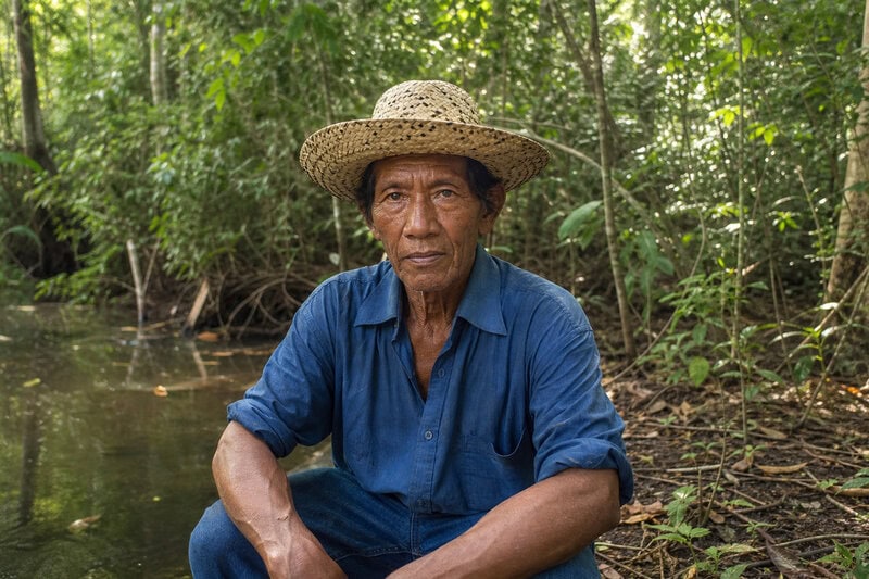
Field research in Suriname’s interior is not a discipline for the impatient. Getting there means river travel on waterways that appear on maps as thin blue lines and in reality present themselves as something considerably more argumentative. It means building relationships, over years and then decades, with Indigenous communities whose oral traditions carry detailed geographic memory of places that appear on no colonial survey — settlements, ceremonial sites, earthworks that outside researchers have not yet recorded. It means cross-referencing ceramic scatters found in riverbank exposures against subtle anomalies in how the vegetation grows above them, because sometimes the only sign that something extraordinary lies below is that the trees are fractionally taller, or a different shade of green, than their neighbours.
For more than two decades, this is the work that archaeological anthropologist Renzo Duin has been doing in Suriname — a duration that is itself a quiet indictment of how under-resourced the discipline remains in this country. Where neighbouring Brazil and Bolivia have attracted major international survey missions and significant institutional investment, Suriname’s pre-Columbian past has been sustained largely by the kind of long, slow, relationship-dependent fieldwork that produces knowledge in increments rather than headlines.
What that fieldwork keeps exposing is a knowledge gap with an uncomfortable shape. Suriname’s indigenous history and its pre-Columbian settlement patterns are not separate subjects — they are the same subject, viewed across different centuries. The communities who guided Duin through the interior, whose ancestors built the earthworks underfoot, hold living knowledge of a landscape that the state has never formally studied and does not legally protect. There is something quietly extraordinary about that: an entire chapter of human history, encoded in oral tradition and in the soil, waiting for an institutional framework that has not arrived.
The Law That Does Not Exist
Here is the legal reality, stated plainly: Suriname has no preventive archaeology legislation. There is no requirement that a mining company, a logging operation, or a road-building project survey for archaeological sites before breaking ground. When a concession is issued in the interior, no archaeologist is dispatched ahead of the excavators. No checklist is completed. The ground is simply opened, and whatever it contained is gone.
Experts describe this not as an oversight but as a chronic absence — a structural gap that has persisted across governments and administrations. Alongside the lack of recognition for Indigenous land rights, Suriname faces a chronic absence of preventive archaeology legislation to protect its archaeological heritage — a paired failure, because the two gaps reinforce each other. Without formal recognition of their territorial rights, the Indigenous communities who have served as custodians of this history for centuries hold no legal standing to challenge the destruction of culturally significant sites. Their knowledge is consulted informally, when researchers like Duin make the effort to seek it out. It is not consulted by law.
The irony is sharpest when you consider Suriname’s international profile. The country holds two UNESCO World Heritage properties — the Central Suriname Nature Reserve, inscribed in 2000, and the Historic Inner City of Paramaribo, inscribed in 2002 — and it projects, with some justification, the image of a conservation-minded small nation taking its environmental responsibilities seriously. The domestic legal framework, at least where archaeology is concerned, does not fully bear that image out. Suriname has been willing to celebrate its heritage when the heritage is colonial-era Dutch architecture. The deeper past has been left to fend for itself.
The 90% Promise and Its Blind Spot
In recent years, Suriname has made a conservation pledge that commands genuine international respect. The government has committed to permanently protecting 90% of its tropical forests — an ambition that places it among the boldest forest-protection pledges anywhere on Earth. Underpinning that commitment is a concrete programme: an initiative to shield more than 7 million hectares of pristine tropical forest, representing nearly 40% of Suriname’s entire land area, from deforestation and development.
These are not small numbers, and they should not be dismissed. Suriname’s forests are among the most intact in the tropics, and the political will to keep them that way is real. The blind spot, however, is structural. Forest protection, as currently designed, protects the canopy. It carries no mechanism to identify, record, or safeguard what lies beneath it. A pre-Columbian earthwork inside a protected forest reserve is no more legally sheltered than one in the path of a gold dredge. The protection stops at the treeline and does not reach the ground.
Duin’s fieldwork keeps illuminating this gap from the inside. The raised earthworks he has documented, the geometric shadows that stop a researcher mid-step in the green dark, exist within landscapes that the government is simultaneously pledging to preserve. They are, in a literal sense, being conserved over — the canopy maintained, the evidence beneath it unrecorded and unprotected. It is a conclusion that sounds polemical until you trace the legal framework and find that it is simply descriptive.
What the Hidden Sites Could Tell Us
The potential, if systematic LiDAR surveys were ever flown over Suriname’s interior, is considerable. The Guiana Shield — the ancient geological formation that underlies much of Suriname — is ecologically and geologically distinct from the rest of Amazonia. It is older, its soils formed differently, its river systems draining in different directions. Settlements discovered here would not simply add data points to the map that LiDAR has already drawn across Brazil and Bolivia. They would represent an independent tradition of pre-Columbian complexity, adapted to a specific and demanding environment, potentially carrying distinct origin stories for the region’s indigenous peoples.
There is also a quieter connection that conservation scientists have begun to take seriously: the biodiversity that Suriname’s government is pledging to protect is not, in many places, purely wild. Pre-Columbian land management left lasting signatures in Amazonian ecosystems — terra preta soils enriched by centuries of human habitation, managed forest gardens whose species composition still reflects ancient decisions about what to plant and where, fish weirs and water-management systems that shaped aquatic habitats across generations. The forests that conservationists prize are, in part, the legacy of the civilizations that archaeologists are trying to find. Protecting one without understanding the other is, at minimum, an incomplete project.
Duin knows this argument from the inside. After more than twenty years of fieldwork, he has accumulated enough evidence to understand both what is there and what is at risk. The next decade will bring new mining concessions, new road projects, new infrastructure pushes into Suriname’s interior — driven by resource prices and development pressures that conservation pledges alone cannot fully redirect. Every one of those projects, in the absence of preventive archaeology legislation, represents a site that may be destroyed before any survey is ever flown.
Why the Forest and Its History Must Be Protected Together
Suriname’s conservation story is, on its own terms, genuinely impressive. The forest coverage is real. The international climate credibility is earned. The UNESCO designations reflect genuine heritage worth celebrating. None of that is in dispute. What is in dispute is whether a conservation framework that treats the forest as natural heritage while leaving its human heritage legally exposed can honestly call itself complete.
The changes required are not, in principle, exotic. Preventive archaeology legislation — requiring survey before development, modelled on frameworks already functioning in Brazil and across much of Europe — would close the most immediate gap. Formal recognition of Indigenous land rights would empower the communities who have been the most consistent guardians of this history to exercise legal standing, not merely offer informal guidance to visiting researchers. And targeted LiDAR survey campaigns, coordinated with the mapping infrastructure that the forest-protection programme has already built, would finally bring Suriname into the same evidential conversation as its neighbours.
The case for urgency is straightforward. Archaeological sites, unlike threatened species, cannot recover once destroyed. A pre-Columbian earthwork erased by a gold dredge or a road cut is gone permanently — the data it contained, the cultural memory it encoded, the ecological history it might have illuminated, all of it lost. The window to document what survives beneath Suriname’s canopy is open now, and the pressures that could close it are already building.
Renzo Duin will, in all likelihood, return to the interior. The raised earthworks will still be there, for now — subtle geometric shadows beneath a canopy that the government has pledged to keep intact. He has spent more than two decades building the case that something extraordinary is buried in Suriname’s jungle, and that the window to document it is not guaranteed to stay open. The keys to understanding pre-Columbian Amazon civilizations may well lie in the ground beneath that forest. Whether they survive long enough to be found depends on whether Suriname decides, in law as well as in pledge, that its ancient human history is worth protecting alongside its trees.