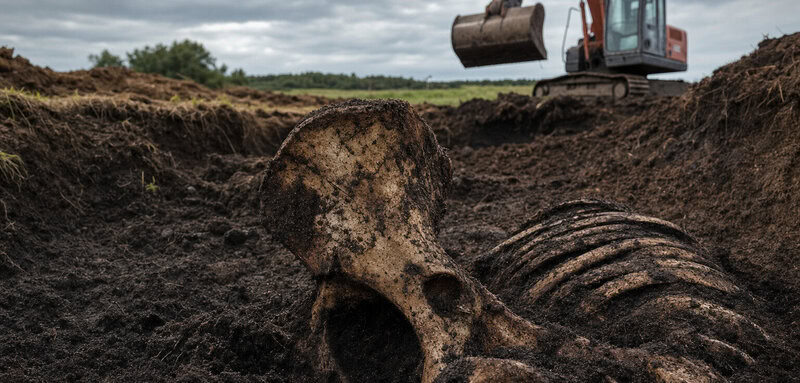
The mechanical digger had been making good progress — until it hadn’t. Somewhere along the projected line of the new N5 road in County Mayo, a bucket swung down into dark, peaty earth and came back up holding something that stopped the crew cold: the unmistakable curve of ancient bone, pale against the soil, patient as only the very long dead can be.
The Man Who Mapped a Road No One Ever Built
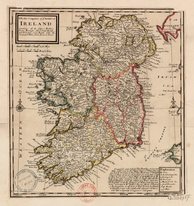
His name was Larkin, and he had stood in this same west Mayo landscape more than two centuries before the first JCB arrived. He surveyed the drumlins and the boggy hollows, the limestone outcrops glinting in Atlantic light, and he drew a line on paper — a proposed road connecting the coast to the inland plain, a route that would have cut travel time, opened trade, and stitched a remote corner of Ireland into the wider world. It was a rational, well-observed plan. It was also never built.
What Larkin could not have known — what no surveyor’s instrument of his era could have told him — was that beneath his boots, sealed under centuries of accumulating peat and soil, lay five thousand years of human occupation. His pencil moved across the map above a Neolithic world he couldn’t see. The field boundaries, the hearths, the graves: all of it was there, waiting in the dark beneath the same corridor he was planning to route his road through.
More than two centuries later, as recorded in Ancient Places: archaeology and history on the N5 Westport to Turlough road project, Co. Mayo, the engineers of Transport Infrastructure Ireland (TII) drew their own line — similar to Larkin’s in its general logic, but more direct in its execution. And almost immediately, the ground began to push back.
Sixty-Nine Sites and Counting
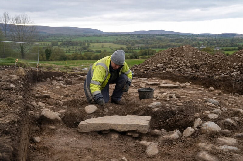
The number deserves a moment’s pause: sixty-nine. That is the count of discrete archaeological sites identified along a single road corridor in County Mayo before construction could proceed — sixty-nine places where the past had left enough of itself behind to require professional investigation. By Irish standards, this is not extraordinary. By the standards of almost anywhere else on earth, it is staggering.
The Archaeological Consultancy Services Unit (ACSU) was appointed to carry out the advance archaeological test excavations and subsequent resolution of 69 identified sites on the road scheme — a two-phase undertaking that proceeded in parallel with the engineering programme. First came the test trenches: sampling the ground, assessing what lay beneath, deciding which sites were significant enough to require full excavation. Then came the full excavations themselves, conducted on a live construction programme, with tarmac waiting on one side and millennia of human history emerging on the other.
This is how Irish road construction archaeology actually works. Under legislation developed over the past three decades, Transport Infrastructure Ireland is required to commission advance archaeological investigation before major infrastructure proceeds. The process is rigorous, occasionally frustrating for road-builders on a deadline, and — as the N5 project demonstrated — capable of transforming our understanding of a landscape entirely.
It is worth being clear about the geography. The N5 Westport to Turlough scheme runs roughly eastward from the coast at Westport across the drumlin-and-bog terrain of central Mayo toward the flat limestone plain at Turlough. Those 69 sites are therefore not scattered thinly across an enormous survey area; they are compressed into a relatively narrow strip of west Connacht ground, which gives some measure of just how densely this landscape was occupied across time.
Before Larkin: A Neolithic World Under the Bog

The earliest layers revealed along the N5 Westport-Turlough corridor take the story back to the Neolithic period, when the first farming communities were remaking the Mayo landscape. They cleared forest, divided ground into fields, built structures of timber and stone, and buried their dead with deliberation. Then, over centuries, the bog crept in — slowly, inexorably — sealing everything in anaerobic darkness where it would remain, chemically preserved, until a digger bucket found it.
What Neolithic archaeology looks like on an Irish road construction project is worth explaining, because it bears no resemblance to the pyramids or stone circles that dominate the popular imagination. It looks like the ghostly negative of a post-hole: a patch of slightly different-coloured soil where a timber once stood and rotted away. It looks like scorched earth around a hearth that was last lit before the Egyptian Old Kingdom began. It looks like a scatter of struck flint — debitage, the technical term for the chips left when someone was making a tool — and the buried courses of stone field walls that predate almost everything we think of as ancient.
These were the fields Larkin’s proposed road would have crossed. They had been divided, farmed, and maintained for thousands of years before his survey. The depth of that occupation was entirely invisible to him, committed to the earth rather than to paper, recoverable only by the kind of careful, slow reading that ACSU’s excavators brought to the work.
The significance of this Neolithic evidence gains additional weight when set against what was already known about prehistoric Mayo. The Céide Fields on the north Mayo coast — an enormous Neolithic landscape preserved beneath blanket bog, with its field systems, dwelling areas, and megalithic tombs — established that the county had been intensively farmed and socially organised at an extraordinarily early date. The N5 corridor discoveries add a new transect to that picture: similar processes of Neolithic clearance, field division, and settlement playing out across a different part of the county, under a different patch of bog, separated from Céide by geology and geography but connected to it by the same deep-time story of Ireland’s earliest farmers.
The Long Middle: Burnt Mounds and Bronze Age Life
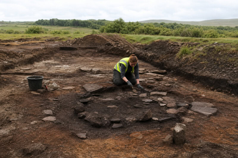
Between the Neolithic and Larkin’s eighteenth century lies a very long time, and the N5 County Mayo archaeological discoveries spanned it with remarkable density. Bronze Age and Iron Age communities left their marks across the corridor — not primarily in the form of monuments, but in the stubborn, unglamorous residue of daily existence: cooking pits, cereal-processing areas, animal bone assemblages, the archaeology of people getting on with things.
Among the most frequently encountered features were fulachtaí fiadh — the burnt mounds that appear on Irish prehistoric sites with almost comic regularity. These water-heating structures, built around stone-lined troughs into which fire-cracked stones were dropped to bring water to temperature, turn up on road construction archaeology projects across Ireland with the reliable frequency of a plot device. They are not glamorous. They are, however, extraordinarily informative: each one represents a communal, repeated use of a particular spot over years or generations, a place people returned to because it worked.
The exact function of fulachtaí fiadh has been debated by archaeologists for decades. Cooking — particularly the boiling of large joints of meat — remains the most widely accepted primary interpretation, supported by experimental archaeology demonstrating that the method works efficiently. But the troughs may also have served in textile production, hide preparation, brewing, or bathing. That ambiguity is itself instructive: these were flexible, multi-purpose facilities, the Bronze Age equivalent of a communal workspace, and their repeated appearance along the N5 corridor suggests a landscape that was not just settled but actively and continuously managed.
What makes the N5 project significant beyond any single find is precisely the transect it provides — a slice across the landscape, resolving 69 sites in sequence, revealing how settlement patterns and land use shifted across millennia. No single excavation can do this. A road can, if someone is paying attention. By the time Larkin was drawing his proposed route, he was tracing a corridor that Bronze Age and Iron Age communities had already used as a natural throughway for more than two thousand years. The logic of the landscape — the drumlins that channel movement, the dry ground between the bogs — does not change. People followed it in 2000 BC, and they followed it in the eighteenth century, and they follow it now on the finished N5.
The Dead Speak: Burials Along the Route
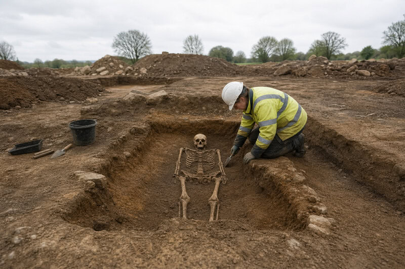
And then there were the graves. This is what stopped the construction crews, what brought ACSU in, what gives the whole project its peculiar power: the landscape had been used as a burial corridor. Multiple burial sites were identified and excavated along the N5 scheme, ranging across different periods, each one requiring the kind of careful, forensic-standard excavation that does not yield to deadline pressure.
The archaeology of Irish road burials is, in its way, a study in how communities relate to movement and to death. A cist grave — a stone-lined box set into the ground — a pit burial, an early medieval inhumation: each represents a deliberate decision about where to place the dead in relation to the living landscape. Roads and pathways were frequently chosen as liminal locations, places where the boundary between worlds felt permeable, where the passing living might acknowledge the stationary dead. The dead, in other words, were not hidden from the road. They were placed beside it, or beneath it, or in its path.
Each burial encountered along the N5 required a formal pause in the works: a licensed archaeologist on site, careful hand excavation of the feature, recording of skeletal position and orientation, recovery of any associated artefacts or samples, and osteoarchaeological analysis to determine age, sex, health indicators, and — where bone preservation allowed — isotopic data that can reveal diet and geographic origin. That process takes days or weeks per feature. It cannot be hurried. And on a live construction programme, every day matters to an engineer with a budget and a programme to meet. The legislation governing Irish road archaeology is explicit: the archaeology takes precedence. The road waits.
Larkin, planning his road through this corridor in the eighteenth century, had no way of knowing he was proposing to thread a route through a landscape that communities had been using as a burial ground for millennia. The N5 builders found out the harder way — one bone at a time, one pause in the programme at a time, one careful season of excavation at a time. Numerous archaeological sites were discovered, providing new insights into aspects of daily life in the region from the Neolithic period to the 19th century — and into aspects of ancient death, too, which is of course only the other side of the same coin.
What the Road Gave Back: Ancient Places in Print
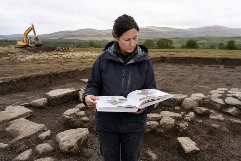
The final product of all this excavation, all these pauses and reassessments and careful seasons in Mayo earth, is a book. Ancient Places: archaeology and history on the N5 Westport to Turlough road project, Co. Mayo is Transport Infrastructure Ireland’s published record of the project — the mechanism by which the discoveries are preserved not in a grey-literature report that will moulder in an archive, but in a narrative accessible to anyone who wants to understand what lay beneath this particular stretch of County Mayo ground.
TII’s publication programme for road archaeology has been running for a number of years and has produced volumes on projects across the country, but the N5 volume carries particular weight because of the density and chronological range of what the corridor produced. The book does not simply list sites and findings; it situates them within the broader archaeological and historical landscape of County Mayo and attempts — ambitiously, and largely successfully — to tell a coherent story across five millennia of human presence in the region.
The volume situates the N5 findings within a county already known for extraordinary prehistoric monuments: the Céide Fields, with their Neolithic landscape preserved under the bog of north Mayo; Croagh Patrick, pilgrimage site since before recorded memory; the dense cluster of early Christian remains around Ballintubber. What road archaeology adds to that picture is texture — the domestic, the ordinary, the private. Not the monument but the hearth. Not the ritual site but the cooking pit. Not the hero’s burial but the neighbour laid in the ground by people who would have grieved and then gone back to their fields. The book documents the archaeological investigations carried out by Transport Infrastructure Ireland in advance of the construction of the new N5, and in doing so, it extends Mayo’s extraordinary prehistoric story into the everyday.
There is also a methodological argument embedded in the project, one that deserves to be made explicitly. The standard criticism of road construction archaeology — that it is reactive rather than research-led, driven by the accident of where a road happens to go rather than by scholarly questions about a landscape — is answered, at least in part, by projects like this one. The N5 corridor was not chosen because archaeologists suspected it would be rich. It was chosen because it was the most efficient route for a road. The fact that it turned out to cut through one of the most archaeologically dense corridors in County Mayo is a function of the landscape itself: the same topographic logic that made this a natural route for prehistoric communities made it a natural route for modern engineers. Road archaeology, in other words, samples the landscape on its own terms rather than on ours — and sometimes, as here, that produces results that no research agenda could have anticipated or planned.
Reading the Palimpsest
Larkin gets the last thought, as he deserves. His unbuilt road was just one more layer in a landscape that had been planned, used, abandoned, and reused by countless generations across five thousand years. He stood on ground thick with the traces of people who had farmed it, cooked on it, buried their dead in it, and moved across it in patterns that obeyed the same underlying logic his road would have followed. He saw the surface. He drew his line. He moved on, and the road was never built, and the landscape kept its secrets for another two centuries.
The N5 is simply the latest line drawn across a palimpsest that begins in the Neolithic. The difference — the one that matters — is that this time, before the road went down, someone stopped to read what was written there. And then they wrote it down themselves, so that the dead, patient as they always were, might finally be heard.